Hi!
I'm Dylan Blisard,
a cartographer 🌎
I'm a graduate from the University of Oregon with a degree in Spatial Data Science and a minor in Climate Studies. I've made maps for the InfoGraphics Lab and Oregon's Jackson County.
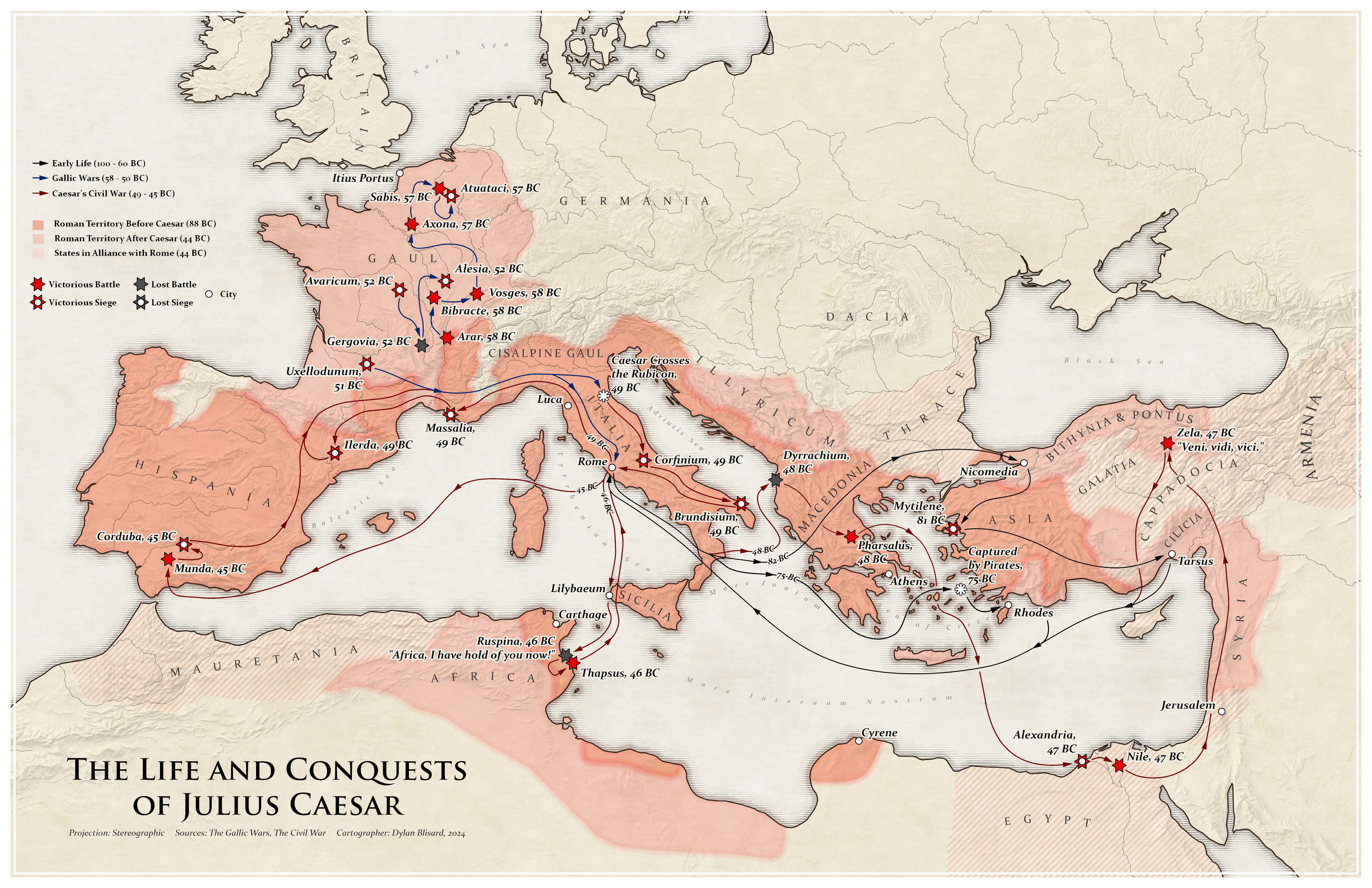
The Life and Conquests of Julius Caesar
December 15, 2024This is a map I've always wanted to do: A complex spatialization of a historical figures entire life. Julius Caesar documented his whereabouts in his Gallic Wars, and Civil Wars memoirs and was therefore a prime personality on my list. I've always been interested in ancient history, especially the fall of the Roman Republic and mapping Caesar's life has given me a much deeper understanding of the why, when, and of course, the where of it all. This map is still a work in progress (WIP) but I wanted to put it out there anyways to share what I'm working on heading into the new year.
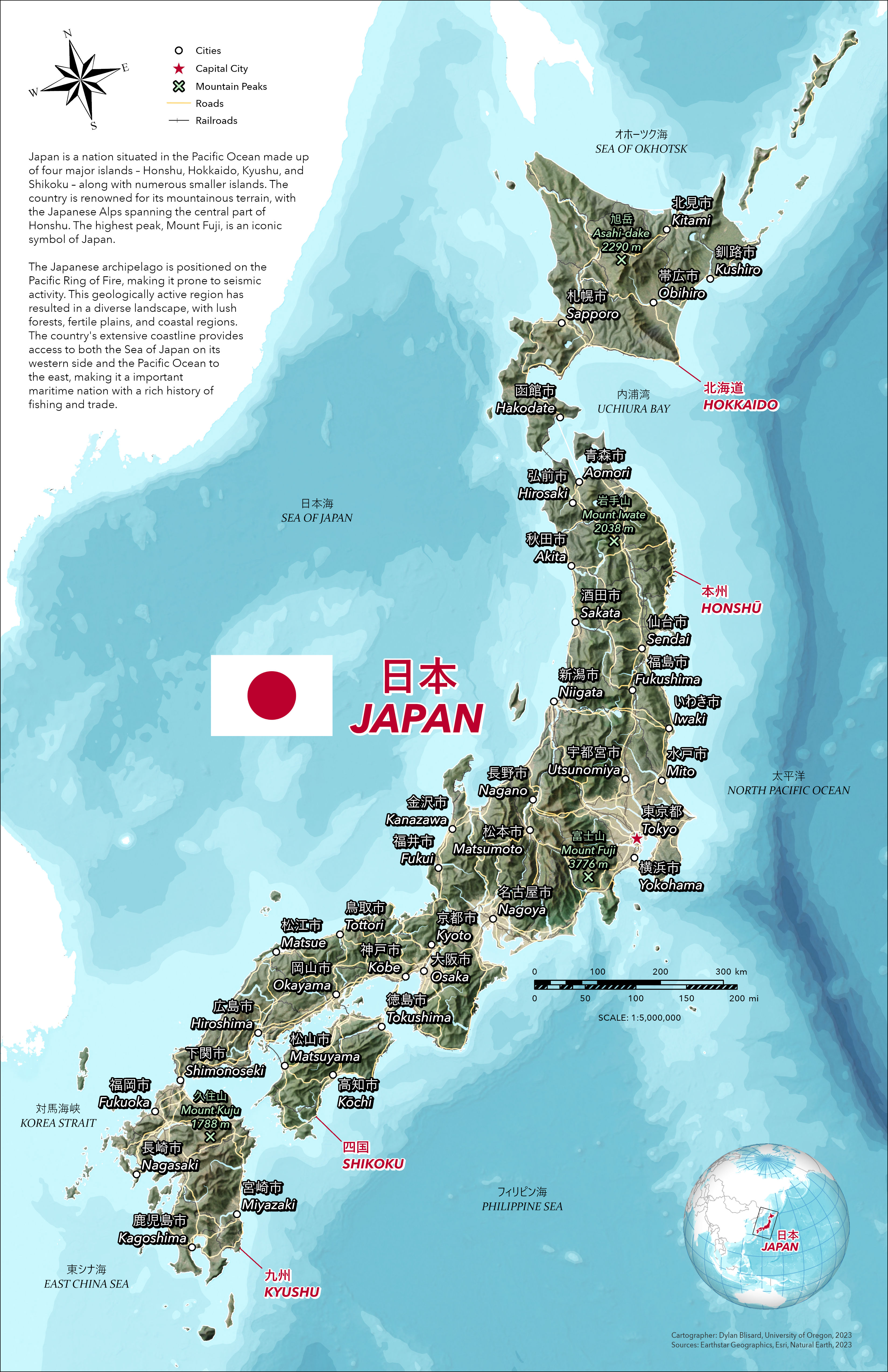
Japan
December 15, 2024A reference map of Japan made using Natural Earth language data with help from my friend who knows Japanese. Remember to get input from and consult the experts when mapping outside your field!
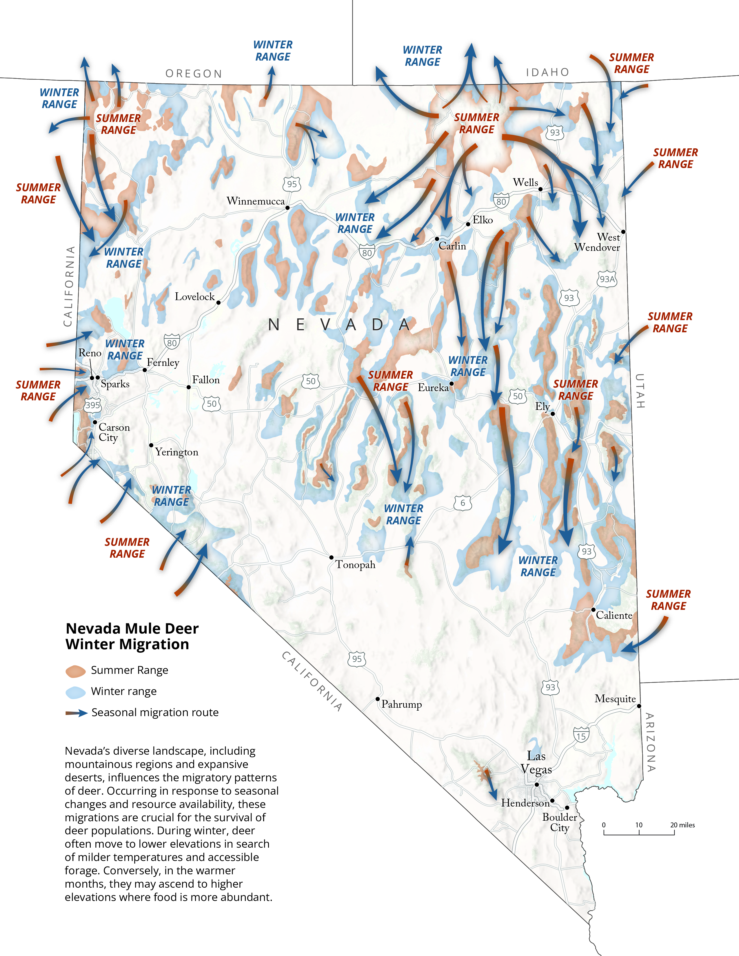
Nevada Mule Deer Migrations
December 15, 2024During my time at the University of Oregon's InfoGraphics Lab, I contributed to a number of projects for the USGS, Nevada Department of Fish and Wildlife, and the Wyoming Migration Inititative (WMI). Every year the USGS releases a report titled Ungulate migrations of the Western United States of which much of the cartography is done by the InfoGraphics Lab. We made fact sheets, web layouts, and more maps for WMI, but of them all this map for the NDFW was my favorite. It was used in a report shown to members of the state legislature to influence funding for wildlife overpasses within the state. It was great to work with the professionals over at NDFW who marked up each iteration of this map with their expertise in the field of ungulate migration.
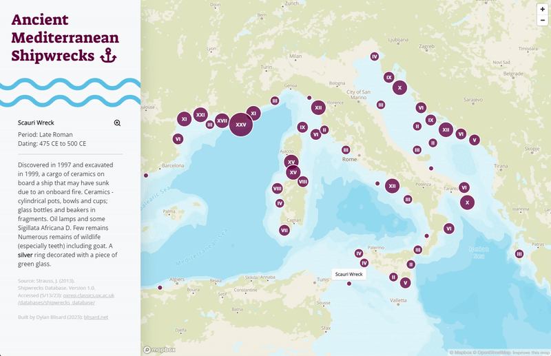
Ancient Shipwreck Explorer
December 15, 2024No description
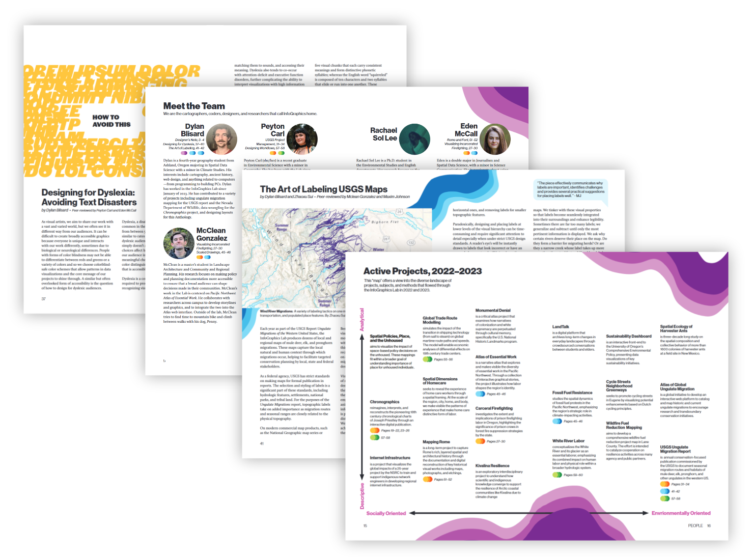
InfoGraphics Lab Anthology
December 2023This was my favorite project I designed for the InfoGraphics Lab. The Anthology was an almost year's long effort by everyone in the lab to come together and create a visual dictionary of all the work we had done that year. Many, many revisions, meetings, and last minute alterations all culminated in a physical book I have on my shelf next to my desk. In total, I worked on 35 spreads with the help of Jenna Witzleben who did the cover page and other graphics, and Alethea Steingisser, our production manager. Everyone had their own spread on topics of their choosing. Mine are 'The Art of Labling' and 'Designing for Dyslexia: Avoiding Text Disasters.'
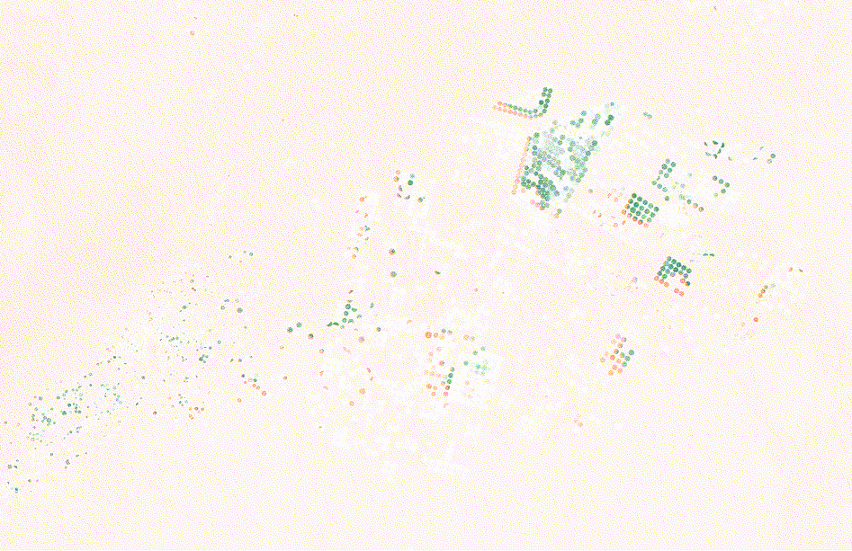
Gravity Anomalies in Saudi Arabia
December 15, 2024Remote Sensing II final project created with Python, Google Earth Engine, and Landsat/GRACE satellite data. I found that as agricultural land increased in Saudi Arabia, the strength of gravity decreased, however minutely. This was due to the steady emptying of the nation's undergound desert aquifers. I was able to calculate agricultural land area in three study areas using SAVI (Soil Adjusted Vegetation Index) which accounts for the surface reflectance of arid climates using Landsat satellite data. To calculate the strength of gravity I used NASA's GRACE Satellites (Gravity Recovery and Climate Experiment). They measure the distance between each other to determine gravity's pull as they orbit the Earth.
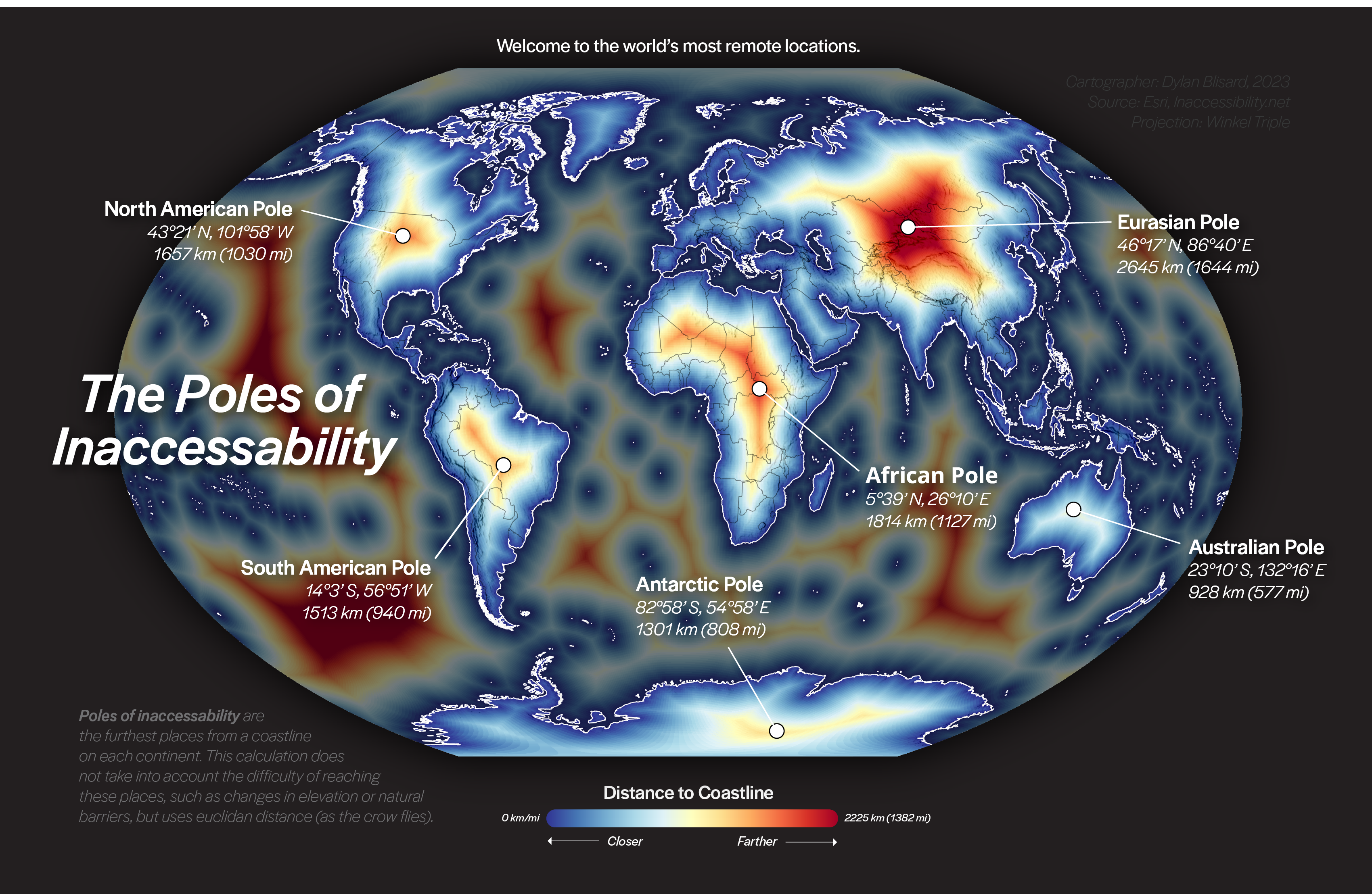
The Poles of Inaccessability
December 15, 2024No description
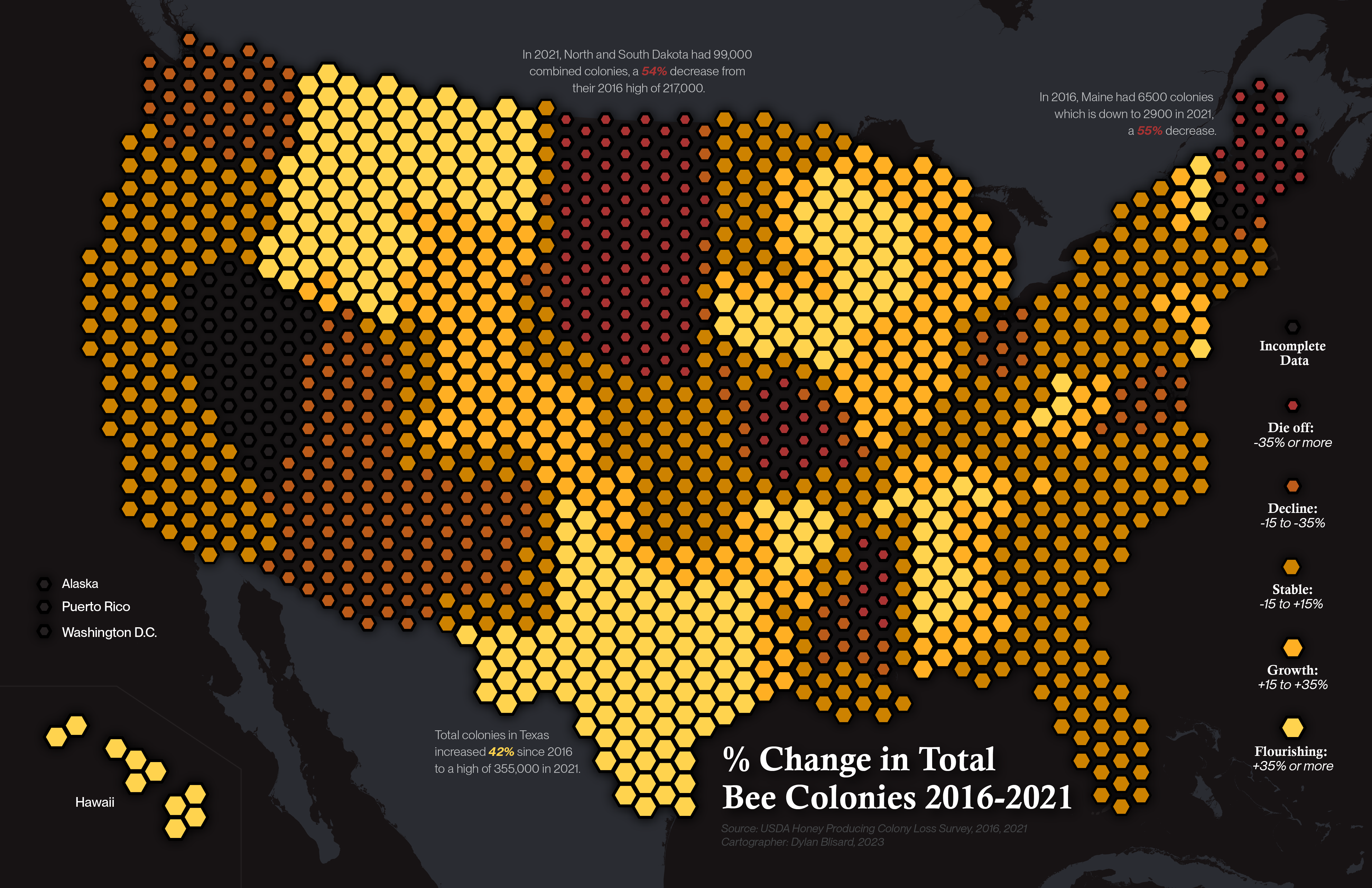
Bee Colonies in the US
December 15, 2024No description
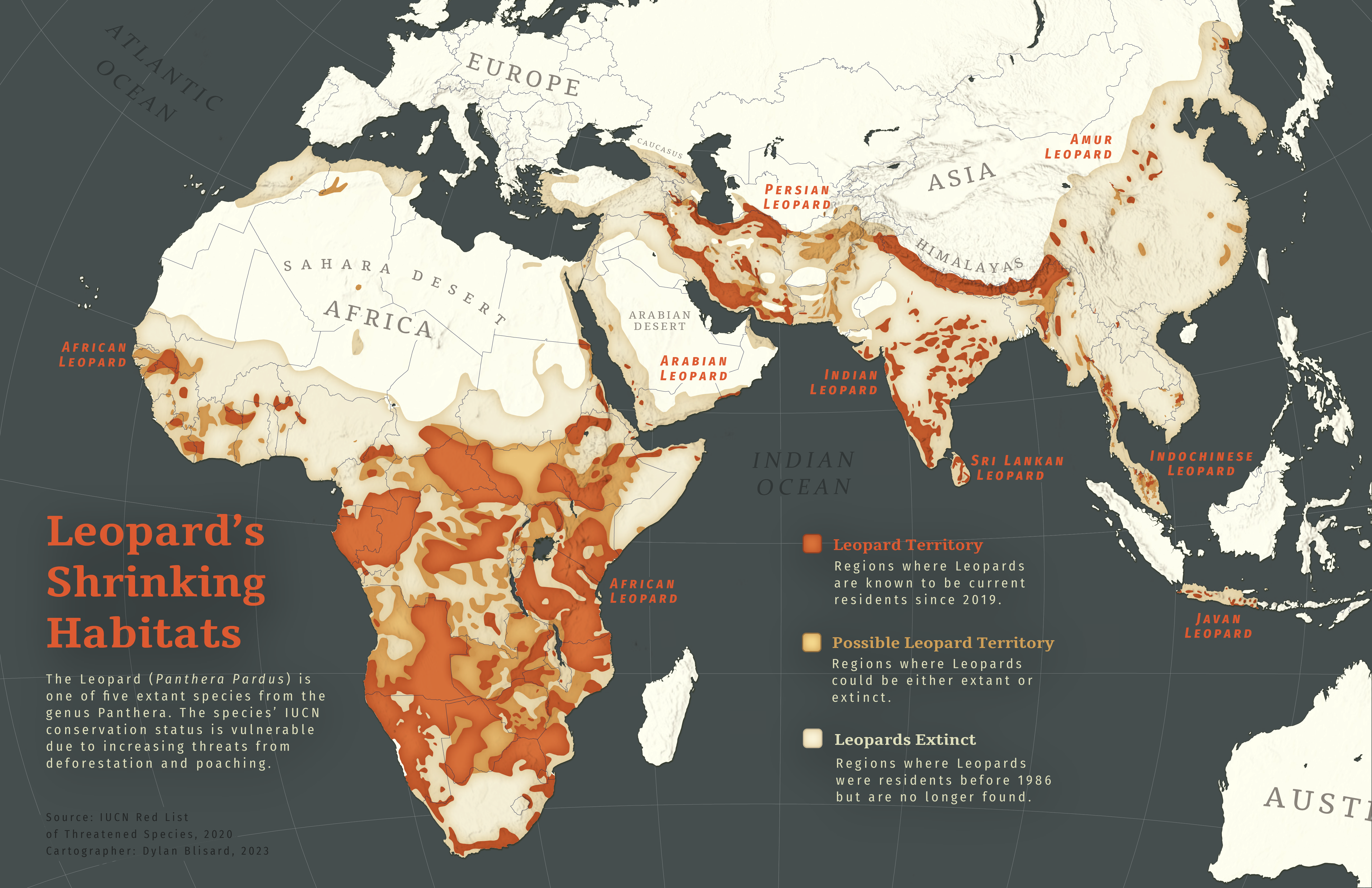
Panthera Pardus Distribution
December 15, 2024No description
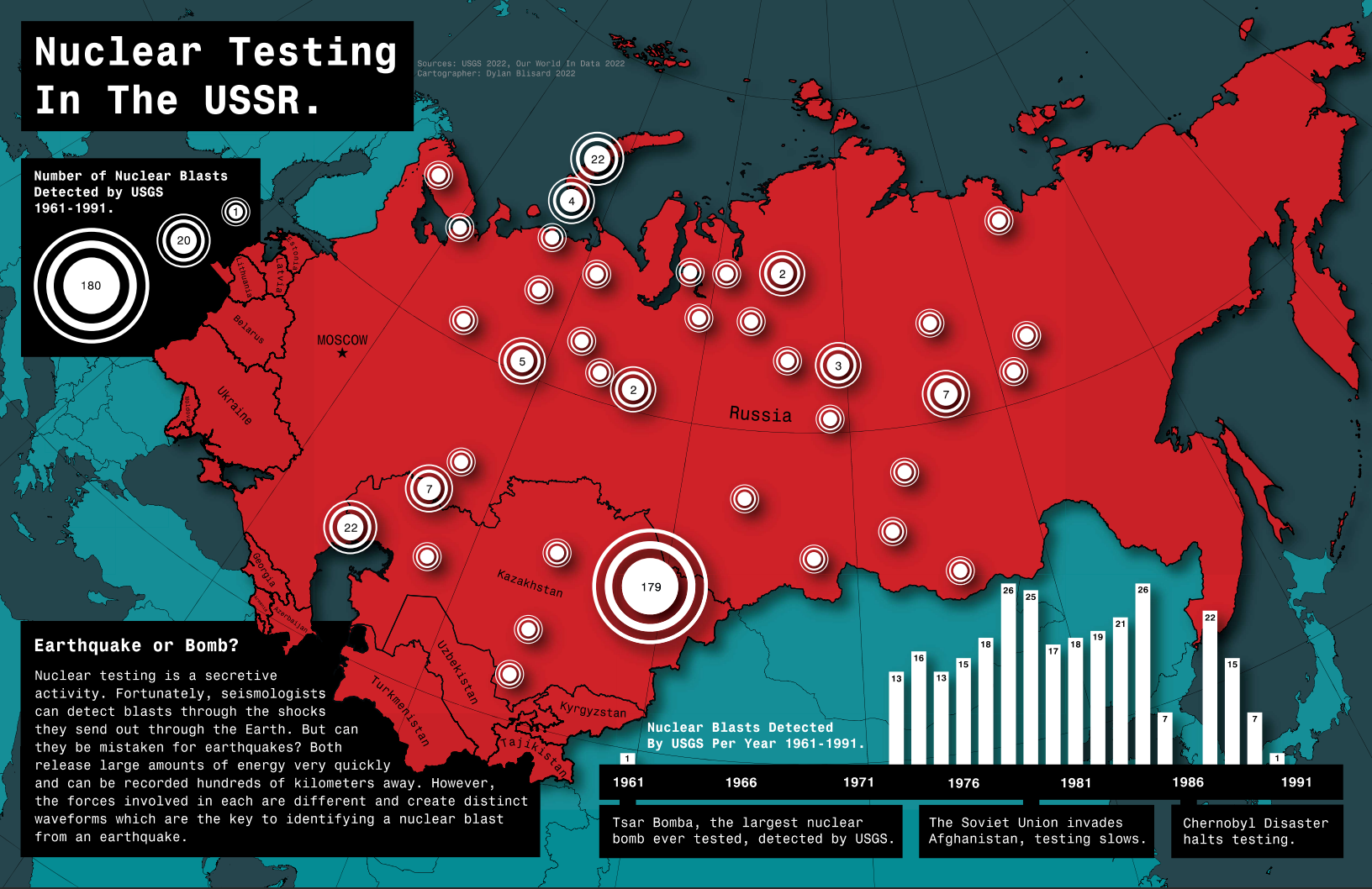
Nuclear Testing in the USSR
December 15, 2024This was one of the first maps I ever made. It was for my Advanced Cartography final and I ended up submitting it to and winning the Bill Loy Award for Cartographic Excellence. It was also my foot in the door at the InfoGraphics Lab.